*I hope people use their own wise judgement when hiking always plan ahead and be prepared. One should never go beyond their abilities.*

Over the years I've had a few goals my first was to Summit all the Peaks of Waterton. Here is My Waterton Summit List I completed that goal on September 26, 2016.

My next goal I'm still working on and that is to summit the 6 10,000 foot Summmits of Glacier National Park. I have one left Kintla.

My 2018 Goal that I accomplished was to summit 40 peaks in my 40th year and that I finished on September 26, 2018.

Not sure what will be my next goal, once Glacier's Summits are done?

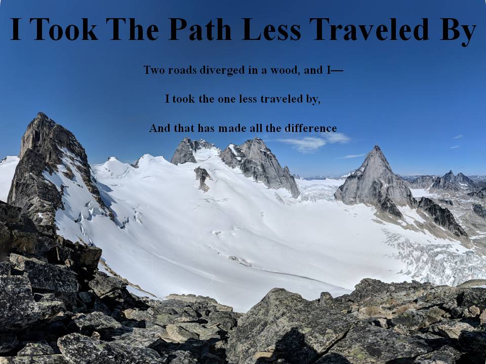
I commonly use 3 Hashtags on my social media. The first one is #itookthepathlesstraveledby which is to reference this blog. The next two relate to my father and grandfather who were also hikers. #milesformarkellingson is to remember my
Dad, Mark Ellingson and #dustfromthetrailandhowitsettledonme is to remember my Grandfather Earl Ellingson

August 24, 2017

Cooper Spur of Mount Hood August 22, 2017

Well the fires are sure ruining a lot of hiking this year.  So we traveled down to Oregon for my nieces wedding and so my brother and I had wanted to do a hike but because of fires and closed areas we couldn't do our planned hike of Middle Sister, so we had to improvise and try something else.  So instead we decided to see how high we could get on Mt. Hood without using gear.  So we decided to go up an approach called Cooper Spur.  My brother had hiked some of it before and it said that we would could easy get to about 9000 feet.  So my son and brother headed out one morning to try and see how high we could go.  We knew we wouldn't make it to the top but we'd see how high we could get.  We drove to Cloud Cap campground and started hiking from there.  We headed up through a nice treed area first and then eventually lost all shade and headed up to about 8800 feet.  The transition from tree to baron volcano ash and rock was cool.  I'm used to hiking on the rocky mountains but this ash and rock mixture was weird.  Reminded me a lot of when we hiked on Mt. St. Helen's.  It was completely void of any vegetation.  It was also very sandy at times and actually made it more labor intensive because you didn't have the push off from the rocks as you stepped but had a little cushion.  I think it is like the difference of running on a turf field as opposed to a harder surface.  There is cushion in the turf  but not on the harder surface as a result the track speed is slower on the turf.  As we climbed we had an OK view of the mountain even though it was smokey.  We really couldn't see anything around us which is a shame because the views I hear are spectacular.  We had a great view of the Eliot Glacier on our north side as we hiked and the crevasses were amazing to see in the glacier.  We eventually got to our high point, saw all the snow ahead and decided that was our day and turned back around.  As we descended we noticed the smoke got thicker and we were glad we had a little clearer view.

First view once the trees cleared of Mt. Hood

Cooper Spur shelter (my camera got some condensation in it, hence the not so clear pictures)

Nearing the top of the Spur

Father and son on the high point for the day

Our "Summit" or high point picture

Coming down, look at the crevasses on the right

View looking down where we came of how void of vegetation this area was

The sandiest part of the hike, almost like walking on the beach
Panorama on Cooper Spur


August 16, 2017

Mount Rowe Aug 16, 2017

Well still tired from last weeks 5 day hike I figured I'd go for something a little closer to home.  I had heard there were trail closures in Waterton and figured that Mt. Rowe was good to go.  I later found out that the trail closures also included all off trail hiking as well...oops.  It was kind of neat to have a helicopter spot us, circle us for a bit and then drop down and get out to tell us to go down.  We initially had hoped to climb the ridge over to Lineham as well but that was thwarted by the Parks Officials...but that was OK we had already bagged one peak for the day.  And I figure it is better to live by the rules and to obey them.  So I had done this hike many years before and so we took the trail all the way up to the Upper Rowe Lake and then went around to the west side of the lake and headed up that ridge and gained the continental divide ridge and took it back all the way to the summit.  Quite an easy hike, we actually had summitted in 2 hours and 30 minutes and the day was looking good to summit Lineham as well until the helicopter met us.  Anyways great day, little hazy from the smoke but we'll have to get Lineham another time, which I'm sure we will.

Rowe Meadow, a little dryer this year due to the heat we have received

Creek coming through Rowe Meadow

Looking down on Rowe Meadow

Upper Rowe Lake

On the continental divide ridge looking at Forum and Wall Lakes

Looking down on Upper and Middle Rowe Lakes

Rowe Lakes again from the Summit

Summit Picture

Cameron Lake and Mt. Custer

This is the ridge we took up from the lake

Our Helicopter visitors

This was the ridge we had hoped to traverse to Mt. Lineham

Heading down

Dried out creek bed between Middle and Lower Rowe Lakes

Middle Rowe Lake

View looking down on Lower Rowe Lake
Panorama on Summit


August 14, 2017

Mt. Stimson August 8-12, 2017

This was quite the adventure! Our group headed out early on August 8 and crossed the border and drove down to Two Medicine to catch the boat across the lake to hike to the Dawson Pass trail.  We traversed the continental divide to Cut Bank Pass to head into the Nyack.  It was a long first day with our huge packs.  Mine weighed 46 pounds to start and it truly made a difference hiking with that much extra weight.  It was a cloudy/smokey day and the views were not very good as we headed along the continental divide towards Cut Bank Pass but we did get a smokey view of our goal Stimson in the distance.  Once we started heading down into the Nyack region we got our first look at the forest fire burned area that burned in 2015.  Our hope was that the fire had burned a good chunk of the bushwhacking we had heard from other peoples reports while going up Stimson.  We hiked about 22 km the first day and camped in our first of 3 undesignated camp spots, which was on quite an incline and the sleep that night was terrible.  We woke up early on day two and headed to our next camp site which we would spend two nights at just under the shadow of Mt. Stimson.  We had thought about heading over to "Ice" Lake but figured it would be better to stay higher up over below the snow pack below the summit of Stimson.  We headed up the Stimson creek drainage and spent the better part of the day bushwhacking up to this camping area.  The fire had not burned as much up this Stimson creek drainage and the day was very hard and the bush was awful.  We eventually made it to our intended site at about 6300 feet just north of a little un-named lake.  It was the reward for the day as it was probably the most beautiful area I had ever camped in.  We set up our tents on this beautiful soft grass flat area and it was soft enough we could have probably not have used air mats.  We then went to bed early that night to get up early the next morning to summit the 2nd highest peak in the park.  We started a little after 6am and got up to the saddle quite nicely.  Then we noticed a storm was coming in and decided to hunker down in some trees just encase it rained.  Well we waited about 30 minutes and nothing came so we headed up the south east ridge.  It was pretty much strait up and seemed to get steeper the higher we went.  We figured it was mostly class 3 climbing the entire way up with maybe some class 4 but nothing too difficult.  We reached the summit by about lunch time and as we were summitting another storm was coming through.  The difference between the first and this one was that we were on the top and we got to experience first had an electrical storm.  My son noticed my hair standing up on edge and some sounds from the metal parts of our equipment.  I even felt little shocks on my head.  We quickly did a summit photo and descended till we no longer had the "shocking" effects of being on top and waited there for a while for the storm to pass.  After about 20 minutes we figured we were fine and regained the summit and spent a fair amount of time up there.  Unfortunately the smoke/haze had worsened and our views were not as clear and spectacular.  But the electrical storm was quite the experience and we counted ourselves lucky to be alive! We then descended and spent the night in our beautiful camp ground.  That night there was another storm and we later heard lightning struck a few sites in the park and started a few fires.  Day 4 we packed up from our little paradise and headed down the bush.  We decided to stay further left (west) of the drainage higher up on the side as to avoid the unburned bush area of the Stimson creek area.  It was much better but we still ran into trouble with all the fire weed in the valley once we got down.  We eventually crossed the Nyack creek and headed to the Upper Nyack campground where we stayed our 4th night.  We got up the next morning early so that we could be back to Two Medicine to take the last boat back across the lake at 5:15pm.  The main disadvantage of this day was the Nyack area is much lower in elevation than the Two Medicine area and to get there we had to regain the contenental divide and Dawson pass and drop back down into Two Medicine.  It was a long grueling 25-26 km day that was very hot and hazy/smokey as well.  We did get to see the area better than on day one because it wasn't as cloudy, but the smoke was still pretty thick.  We eventually made it to the boat to thus complete one of the toughest hiking trips I've ever done.  We were all exhausted and our feet were all very sore.  We figured we put on around 70 km in the 5 days and climbed around 15-16 thousand feet of elevation (total elevation ups and downs).  The sad thing was when we finished my pack was only about 5 pounds lighter and when I got home I was only 5 pounds lighter as well.  In contrast my son's pack dropped about 13 pounds, I guess I better redistribute the weight more equally next time eh!  But all in all this was quite an adventure and I'm glad to have this peak crossed off my list.

Getting our packs all ready at Two Medicine

Riding the boat over to the other side of Two Medicine lake

The beginning of our adventure

Our first hazy view of Stimson (very faint in the middle)

Flinsch Peak poking through the clouds

Our first view of the burned area of 2015

Another burned view coming down into the Nyack

At first I thought this fireweed was pretty, but by the end of the 5 days I'd seen enough of it!

Day two view of Stimson from where we camped

Getting ready to cross the Nyack Creek on Day 2

First part of day 2 wasn't too bad through the burned area

Pretty meadow just before it started to get ugly in the bush, Stimson on the right

Starting to get bushy

View looking back at the bush we had gone through

Father and son picture, finished the bushwhacking

Our tent view overlooking the peaks to the north

View looking south out our tent to Mt. Pinchot

Another view of our beautiful tenting area below Mt. Pinchot in background

Day three the beginning of the climb (Summit day)

Sun peaking through the clouds over Tinkham Mountain in center right

Climbing the cliff just before the saddle between Stimson and Pinchot

Another cliff view with Stimson peak in sight

Heading up the Southwest ridge of Stimson

Looking down at the saddle between Stimson and Pinchot

Another view of the same saddle a little higher up

Carter on the summit checking out the cairn

Our electric storm summit photo, notice the hair standing up and the worried looks on our faces!

Father and son on summit with Pumpelly Glacier behind us

2nd Summit group photo without the electrical storm!

Heading down looking down on the saddle we'll descend to

View of Ice Lake on the left

On the cliffs below the saddle

Sliding down the ice pack

Checking out the ice pack that was above our camp spot

Sunrise on Day 4

Heading down the moraine below the ice pack

Father and son in front of the ice pack

Leaving the ice pack

Still quite a bit of bushwhacking on day 4 but significantly less than day 2

Day 4 descent in some bush

Day 4 was so hot that I sweated more than I think I have ever sweated, I had to keep checking to see if my bladder was leaking water because it seemed like I had wet my pants!

Upper Nyack Campsite loo with a view of Stimson

Father and son showing off their "swass" (sweaty ass)

Looking back at Stimson in the haze

Anther view coming around Mt. Morgan with Stimson in the middle

Traversing the continental divide around Mt. Flinsch to Dawson Pass

At Dawson pass ready to descent down to Two Medicine Lake
Bushwhacking Video

Photo Sphere View of Day 2 and 3 Camp Spot

Panorama on Summit

Summit Video (right before we had electric storm)

Photo Sphere on Saddle

Panorama at Cut Bank Pass

Panorama Between Mt. Morgan and Mt. Flinsch

Track of Day 1

Track of Day 2

Track of Day 3 (Summit Day)

Track of Day 4

Track of Day 5